Unlock the Full Potential of Your Built Assets with 3D Scanning and Digital Twin Solutions
At Twinar, we deliver precise 3D scanning and Digital Twin creation to help you visualize and manage your assets like never before. Our expertise ensures accurate digital representations of your spaces, empowering you to explore new possibilities for maintenance, operations, and strategic planning.
WHAT WE DO

3D Scan

Digital Twin

Further Functions

Twinar SERVICE
Our service includes professional 3D scanning to create accurate digital twins of your existing buildings, complete with essential tools for visualisation, navigation and data extraction. These features enable effective asset management and operational planning. For more specific needs, there is an option to discuss and develop bespoke solutions to further integrate your Digital Twin into specialized applications tailored to your needs.
-
A crucial step in capturing physical spaces is the 3D scan, where we use advanced laser scanning technology, such as the LiDAR-enabled Matterport Pro 3 camera, to record precise details. This process generates an accurate 3D Digital Twin, forming a reliable foundation for spatial analysis and visualization.
-
Once the 3D scan is complete, the captured data is processed and organized into data packages. These packages contain all the necessary information about the space, including geometry, textures, and metadata, enabling seamless integration with various software and applications. The possible exports are high quality 2D and 360° pictures (JPEG), 2D Plans, 3D Model (.OBJ and textures), Pointclouds and BIM Model
-
By combining laser scanning with high-resolution panoramic photography, we deliver an interactive digital space. This allows you to view detailed textures, explore your environment, and take accurate measurements seamlessly. Additionally, you can easily share the tour, embed it on websites, or explore it in virtual reality, offering a dynamic and engaging experience.
-
Users can enhance their digital twin by adding tags, notes, and documents to specific elements within the virtual space. This allows for real-time collaboration, easy annotation, and effective information sharing among stakeholders. Multiple users can access the model simultaneously, communicate via integrated messaging, and attach relevant files. For more sophisticated workflows, integration with advanced planning tools like Autodesk Construction Cloud and Procore further enhances coordination and streamlines project management.
DATA PACKAGES
High resolution images
(.JPEG)

360° Images
High-resolution 360° panoramic images (.JPEG)

2D PLANS
(PDF, DWG, SVG, PDF Colorized Image, TruePlanTM for Xactimate®)

3D Model
(.OBJ + Textures)

Pointcloud
(.XYZ, .e57)

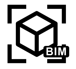
BIM Model
(.RVT)